The summer of 1996, I was driving out to the Fox River. I no longer recall why. I was 40 years old and had never fished a river before. I had no clue at that point how to fish a river. I had read a few articles on river fishing; cast 1/8 ounce or heavier jigs and twisters up stream and let them bounce back down stream. Don’t recall the reasoning behind doing that other than this presentation was supposed to be mimicking river food tumbling down the river.
Sounded good to me. I had all my fishing gear in the car, so I must have been driving that way intentionally, though I no longer recall if getting to the Fox was my actual goal.
I crossed the Fox River at Indian Trail Road on the north end of Aurora. There was an island park, so I pulled onto the island. For some reason I picked the east channel to fish and spent a couple of hours throwing heavy jigs up stream just like I had read. I recall losing a few of the lures to the rocks, but I also recall catching a few smallmouth bass.
And with that, my obsession with fishing flowing water began.
Within a month I had bought a pair of hip boots and a DeLorme Illinois Atlas and Gazetteer.

The hip boots only lasted a few months. I quickly learned that I needed to be out wandering around in the river and not just walking along the shore line. The book of maps has taken a beating in the last 16 years. Pages have been coming apart and clear packing tape is the only thing holding together quite a bit of the book.

Luckily, the paper is pretty tough, lots of dog ears and torn pages, but nothing I couldn’t live with.

I don’t travel very much for the opportunity to go fishing. Once I found out about and figured out how to fish the rivers in the Chicago area, it seemed pointless to travel. Now I can walk down a hill and be in the Fox River in about 2 minutes. If I felt like driving, I can drive for 25 minutes and be on one of the best stretches of the DuPage River for smallmouth bass.

Less than an hour will get me to Kankakee River State Park.

In less than 15 minutes I can be fishing very productive spots on any one of a half dozen creeks that feed the Fox. If I wanted to drive for another 10 or 15 minutes, I can add three more Fox creeks to the list. I’ve waded many miles of these rivers and creeks, but the miles I have yet fished far outnumber the miles I have fished.

Now with the way the price of gas has gone over the last few years, it’s become hard to justify burning off a tank of gas or more for the opportunity to wet a line.
My decision to not travel has been made that much easier by the fact that I don’t fish lakes and ponds. If it’s not moving and I can’t walk in it, I’m not all that interested.
With hunting season over for the year and the weather slowly making an effort to warm, February seems to become the month where I start making plans. I’ve always noticed that others make up their fishing wish lists at the end of the year. Many of these wish lists require driving long distances or getting on planes to reach their destinations.
I get out my dog-eared and beat to crap copy of the Illinois Gazetteer and drive the back roads of the northern quarter of Illinois with the tip of my finger and I dream of places to go. My index finger road trip takes me down back roads through what I imagine are endless fields of corn and soybeans, through little towns that are barely a small spider web of little red lines around an intersection.

I avoid the obvious wide blue indications of the bigger rivers and look for those razor thin blue streaks that feed them. These are the little creeks and rivers that create threads through out this northern quarter of the state.

Get out a map and look at the area bounded by the Fox River on the east, the Rock River to the west, our border with Wisconsin to the north and south to I-80. In this area are enough rivers and creeks to explore that I can probably stay busy for the rest of my life. Each little river and every feeder creek would have to be visited numerous times in the course of a year, not just once and never to be fished again.
I fished the Kishwaukee River near Cherry Valley years ago, but there are a few different branches of this river that snake throughout this part of the state. I have marks all over my Gazetteer on where to park for access. Kilbuck Creek meets up with the Kishwaukee just south of Rockford. I’ve never had the opportunity to go look, but I understand the area where they meet is stunningly beautiful.
Heading down stream from there along the Rock River, I have marks all over my maps. They start at Stillman Creek and move on to Black Walnut Creek, Honey Creek, Kyte River, Clear Creek, Franklin Creek and even one that’s just called Three Mile Branch.
On the south end of the area along I-80 the marks on my map continue. These all flow more or less south into the lower end of the Fox or down into the Illinois River. The name Crookedleg Creek is one of my favorites just for the way it sounds. Nearby is Buck Creek and then as you head west along I-80 you come across Pecumsegan Creek, Tomahawk Creek, the Little Vermillion River (which I hear is outstanding), Spring Creek and as you get out around Princeton you come across the three branches of Bureau Creek.

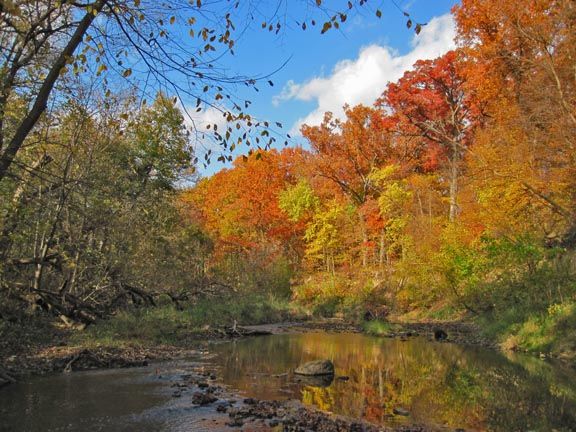
When you look at the map and the thin spidery lines that make up these small rivers and creeks, you’ll probably think I’m nuts for wanting to do this. How things look on maps can be deceiving. The creeks I fish that feed the Fox, which will remain nameless, look no different than any other of these thin blue lines. Yet when I get to the creeks, their valleys are a good half mile wide. Dense, almost impenetrable woods line the creeks and at times you’re standing 50 feet above the water looking down steep bluffs that are impossible to descend.
There’s no reason any one of these creeks and rivers I’ve marked on my maps shouldn’t look the same as the creeks I already fish on a regular basis.
Now take a look at the maps again. Look at the area bounded by the Rock River, the Mississippi River and the Wisconsin border. I’ve already fished the Apple and Galena Rivers as well as Smallpox Creek.

In case you haven’t been paying attention, the new state record walleye recently came out of the Pecatonica River. The northwest corner of Illinois is our driftless area. Down in all those valleys are stunningly beautiful little streams. I don’t think I have enough years left allocated to my life that will allow me to explore this area the way I would like.
There’s a rumor I’ve heard going around for years that down in one of those valleys in the driftless area, as far off into the northwest corner of Illinois that you can possibly get, is one stream that holds a population of native trout. The hints are out there, but the details are not.

That’s the one creek in particular I’d like to get to someday.
____________
16 years and three cars later, that original Gazetteer was finally allowed into the house. With the recent arrival of a birthday present from my daughter, a brand spanking new copy of a Gazetteer, it was time to retire the old dog eared, taped together, beat to crap original book of maps that has served me well over the years.

Maybe I’ll let the new one into the house now and then.
Pat Harrison
26 Feb 2012Interesting read Ken, I agree about fishing close to home. I am doing most of my guide trips within 75 miles of home. Most of this years trips are going to be to Shabbona as its a Great mult- species fishery.
Ken G
26 Feb 2012Thanks Pat. Never could do lakes around here. I got spoiled when I was in the rod and gun club in Virginia. Then I would sit out in a canoe on the lakes all day. Difference was, I wouldn’t see another human being all day.
Walt Franklin
26 Feb 2012Ken,
With the price of gas raising the roof now it’ll be easier to focus on the close to home streams. Thing about it is, you can fish an interesting area for years and never come close to fishing all of it. And if you do make all the waters and come to swing around another time, you find amazing changes because the waters are constantly reforming. The dynamics of it all is intriguing. And a good Gazeteer is the best guide going (after my beloved topographic maps).
Ken G
26 Feb 2012Walt, I have a collection of topo maps on paper and an even bigger one I’ve downloaded over the years from the USGS site. In a previous life, I studied land planning and became addicted to maps.
It’s the ever changing nature of rivers and creeks that keeps me there. One creek near my house completely changed after flooding in Aug. 2008. One downed tree across a creek can completely change a creek for a few hundred yards downstream. I’ve had the luck to be able to document some of this. I’m such a creek nerd.
Larry Granat
17 Jan 2014I use my Gazetter a lot. For birding and for traveling. Deb and I took a ride yesterday out to Franklin Grove, up to the Nachusa grasslands, Lowden Miller forest, then crossed the Rock river in Oregon and came back down the other side. All back roads there and back. Couldn’t do it without my Gazetteer.
Ken G
17 Jan 2014I go back and forth between the Gazetteer and aerial photos before I head out Larry. There are little things in the aerial photos that tell me much more. Like parking spots off of remote bridges off little creeks. Sounds like a nice drive you took.
Lorenzo Swanson
18 Feb 2015KenG,
The Du Page river is mostly where I fish. The section you speak about: “one of the best stretches of the DuPage River”, must be between Channahon and Shorewood. Its like trying to find the proverbial pot of Smallmouth Bass Gold, so to speak.
The Vermilion is also supposed to have an excellent stretch too. The tough question is where to find natural scenic creek/river beauty fishing for Smallmouth Bass.
From some of your photographs it seems you also enjoy that aspect too.
Thanks,
Cereekfisher1